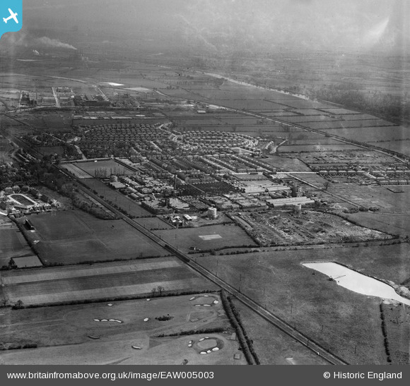
EAW005003 ENGLAND (1947). The Ericsson Telephone Works and the residential area surrounding Beech Avenue, Rylands, from the west, 1947
© Copyright OpenStreetMap contributors and licensed by the OpenStreetMap Foundation. 2026. Cartography is licensed as CC BY-SA.
Nearby Images (8)
Details
| Title | [EAW005003] The Ericsson Telephone Works and the residential area surrounding Beech Avenue, Rylands, from the west, 1947 |
| Reference | EAW005003 |
| Date | 7-May-1947 |
| Link | |
| Place name | RYLANDS |
| Parish | |
| District | |
| Country | ENGLAND |
| Easting / Northing | 452887, 335719 |
| Longitude / Latitude | -1.213383776269, 52.915968139573 |
| National Grid Reference | SK529357 |
Pins
Be the first to add a comment to this image!


![[EAW005003] The Ericsson Telephone Works and the residential area surrounding Beech Avenue, Rylands, from the west, 1947](http://britainfromabove.org.uk/sites/all/libraries/aerofilms-images/public/100x100/EAW/005/EAW005003.jpg)
![[EAW005002] The Ericsson Telephone Works and the residential area surrounding Beech Avenue, Rylands, from the south-west, 1947](http://britainfromabove.org.uk/sites/all/libraries/aerofilms-images/public/100x100/EAW/005/EAW005002.jpg)
![[EAW005006] The Ericsson Telephone Works and the residential area surrounding Beech Avenue, Rylands, from the west, 1947](http://britainfromabove.org.uk/sites/all/libraries/aerofilms-images/public/100x100/EAW/005/EAW005006.jpg)
![[EAW005000] The Ericsson Telephone Works and the residential area surrounding Beech Avenue, Rylands, from the west, 1947](http://britainfromabove.org.uk/sites/all/libraries/aerofilms-images/public/100x100/EAW/005/EAW005000.jpg)
![[EAW004246] The British Ericsson Telephone Works, Rylands Estate and environs, Beeston, from the west, 1947](http://britainfromabove.org.uk/sites/all/libraries/aerofilms-images/public/100x100/EAW/004/EAW004246.jpg)
![[EAW004243] The British Ericsson Telephone Works, Rylands Estate and environs, Beeston, from the west, 1947](http://britainfromabove.org.uk/sites/all/libraries/aerofilms-images/public/100x100/EAW/004/EAW004243.jpg)
![[EAW004245] The British Ericsson Telephone Works, Rylands Estate and environs, Beeston, from the north-west, 1947](http://britainfromabove.org.uk/sites/all/libraries/aerofilms-images/public/100x100/EAW/004/EAW004245.jpg)
![[EAW004239] The British Ericsson Telephone Works, Rylands Estate and environs, Beeston, from the south-west, 1947. This image was marked by Aerofilms Ltd for photo editing.](http://britainfromabove.org.uk/sites/all/libraries/aerofilms-images/public/100x100/EAW/004/EAW004239.jpg)