
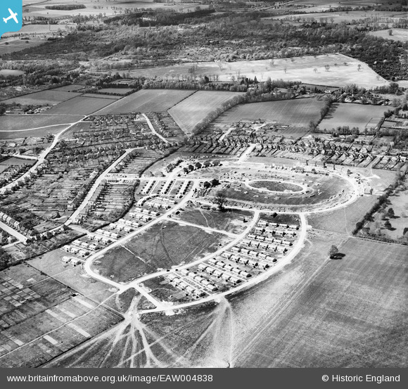
EAW004838 ENGLAND (1947). Housing under construction around Halifax Road, Lincoln Road, Sunderland Road and Blenheim Road, Maidenhead, 1947
© Copyright OpenStreetMap contributors and licensed by the OpenStreetMap Foundation. 2026. Cartography is licensed as CC BY-SA.
Nearby Images (2)
EAW004838

EAW004839

Details
| Title | [EAW004838] Housing under construction around Halifax Road, Lincoln Road, Sunderland Road and Blenheim Road, Maidenhead, 1947 |
| Reference | EAW004838 |
| Date | 29-April-1947 |
| Link | |
| Place name | MAIDENHEAD |
| Parish | |
| District | |
| Country | ENGLAND |
| Easting / Northing | 486588, 181745 |
| Longitude / Latitude | -0.75167019481783, 51.527489539931 |
| National Grid Reference | SU866817 |
Pins
Be the first to add a comment to this image!