
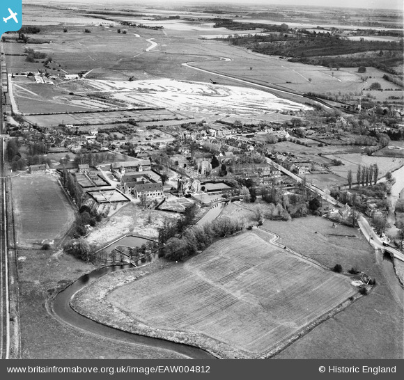
EAW004812 ENGLAND (1947). The village, Sturry, from the west, 1947
© Copyright OpenStreetMap contributors and licensed by the OpenStreetMap Foundation. 2026. Cartography is licensed as CC BY-SA.
Nearby Images (4)
EAW004812

EAW004813

EAW004810

EAW004811

Details
| Title | [EAW004812] The village, Sturry, from the west, 1947 |
| Reference | EAW004812 |
| Date | 25-April-1947 |
| Link | |
| Place name | STURRY |
| Parish | STURRY |
| District | |
| Country | ENGLAND |
| Easting / Northing | 617350, 160100 |
| Longitude / Latitude | 1.1181388767613, 51.29796086338 |
| National Grid Reference | TR174601 |
Pins

Matt Aldred edob.mattaldred.com |
Thursday 11th of March 2021 09:02:41 PM | |

Sparky |
Sunday 13th of August 2017 09:18:10 PM | |
|
Sparky |
Sunday 13th of August 2017 09:16:25 PM | |
|
Sparky |
Tuesday 4th of July 2017 12:19:27 AM |