
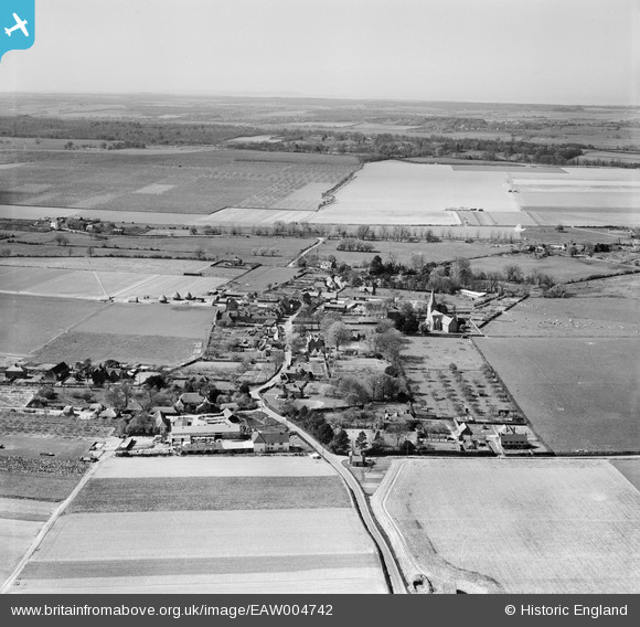
EAW004742 ENGLAND (1947). The village and the surrounding countryside, Ickham, from the south-east, 1947
© Copyright OpenStreetMap contributors and licensed by the OpenStreetMap Foundation. 2026. Cartography is licensed as CC BY-SA.
Nearby Images (3)
EAW004742

EAW004739

EAW004740

Details
| Title | [EAW004742] The village and the surrounding countryside, Ickham, from the south-east, 1947 |
| Reference | EAW004742 |
| Date | 26-April-1947 |
| Link | |
| Place name | ICKHAM |
| Parish | ICKHAM AND WELL |
| District | |
| Country | ENGLAND |
| Easting / Northing | 622404, 157880 |
| Longitude / Latitude | 1.1891428272059, 51.276076030229 |
| National Grid Reference | TR224579 |
Pins

Matt Aldred edob.mattaldred.com |
Thursday 11th of March 2021 08:32:18 PM | |
|
Matt Aldred edob.mattaldred.com |
Tuesday 24th of November 2020 11:36:06 PM | |
|
Matt Aldred edob.mattaldred.com |
Tuesday 24th of November 2020 11:35:49 PM | |

cptpies |
Thursday 12th of December 2013 01:55:34 PM | |
This pill box is still there at the junction of Baye Lane & Wingham Road. Looks as good as new which it was in my garden! |
Stuart |
Thursday 12th of December 2013 02:14:08 PM |
User Comment Contributions

Type 24 pillbox, Ickham. |
cptpies |
Thursday 19th of December 2013 02:12:16 PM |