
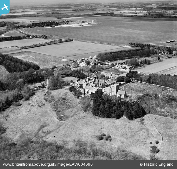
EAW004696 ENGLAND (1947). Lympne Castle, St Stephen's Church and Lympne Airport, Lympne, 1947
© Copyright OpenStreetMap contributors and licensed by the OpenStreetMap Foundation. 2026. Cartography is licensed as CC BY-SA.
Nearby Images (7)
EAW004696

EAW004697

EAW004698

EAW004699

EAW004701

EAW004700

EAW004695

Details
| Title | [EAW004696] Lympne Castle, St Stephen's Church and Lympne Airport, Lympne, 1947 |
| Reference | EAW004696 |
| Date | 26-April-1947 |
| Link | |
| Place name | LYMPNE |
| Parish | LYMPNE |
| District | |
| Country | ENGLAND |
| Easting / Northing | 611900, 134674 |
| Longitude / Latitude | 1.0250737477098, 51.071680160413 |
| National Grid Reference | TR119347 |
Pins

Matt Aldred edob.mattaldred.com |
Friday 7th of March 2025 08:46:07 AM | |
|
Matt Aldred edob.mattaldred.com |
Thursday 6th of March 2025 06:44:42 PM | |
|
Matt Aldred edob.mattaldred.com |
Thursday 6th of March 2025 06:42:45 PM | |
|
Matt Aldred edob.mattaldred.com |
Thursday 6th of March 2025 06:42:26 PM | |

cptpies |
Thursday 28th of November 2013 10:21:17 AM | |
|
totoro |
Friday 25th of October 2013 10:51:44 PM | |
|
totoro |
Friday 25th of October 2013 10:51:03 PM | |
|
totoro |
Friday 25th of October 2013 10:50:44 PM | |
|
totoro |
Friday 25th of October 2013 10:50:19 PM | |
|
totoro |
Friday 25th of October 2013 10:50:00 PM | |
|
totoro |
Friday 25th of October 2013 10:49:37 PM |