
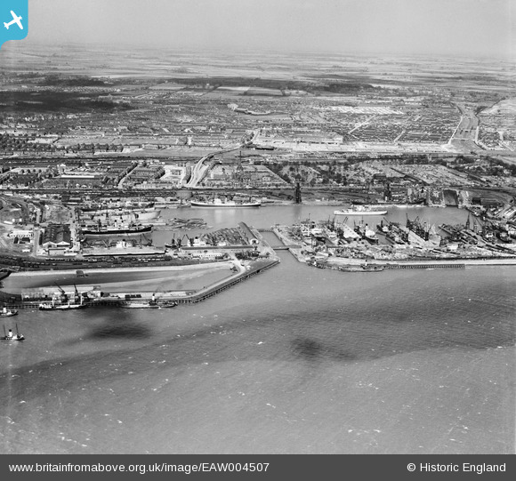
EAW004507 ENGLAND (1947). Alexandra Dock and environs, Kingston upon Hull, from the south, 1947
© Copyright OpenStreetMap contributors and licensed by the OpenStreetMap Foundation. 2026. Cartography is licensed as CC BY-SA.
Nearby Images (7)
EAW004507

EPW036406

EPW036379

EAW046142

EPW036427

EAW324975

EPW036392

Details
| Title | [EAW004507] Alexandra Dock and environs, Kingston upon Hull, from the south, 1947 |
| Reference | EAW004507 |
| Date | 16-April-1947 |
| Link | |
| Place name | KINGSTON UPON HULL |
| Parish | |
| District | |
| Country | ENGLAND |
| Easting / Northing | 512372, 428516 |
| Longitude / Latitude | -0.29602521040899, 53.740676829998 |
| National Grid Reference | TA124285 |
