
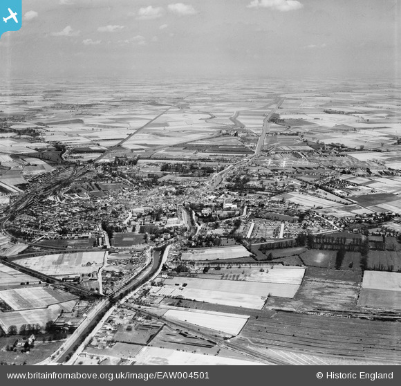
EAW004501 ENGLAND (1947). The town and surrounding fenland, Spalding, from the south-west, 1947
© Copyright OpenStreetMap contributors and licensed by the OpenStreetMap Foundation. 2026. Cartography is licensed as CC BY-SA.
Nearby Images (2)
EAW004501

EAW004502

Details
| Title | [EAW004501] The town and surrounding fenland, Spalding, from the south-west, 1947 |
| Reference | EAW004501 |
| Date | 16-April-1947 |
| Link | |
| Place name | SPALDING |
| Parish | |
| District | |
| Country | ENGLAND |
| Easting / Northing | 524685, 321699 |
| Longitude / Latitude | -0.1512886777704, 52.778122887306 |
| National Grid Reference | TF247217 |
Pins

Matt Aldred edob.mattaldred.com |
Sunday 2nd of March 2025 04:31:33 PM | |
|
Matt Aldred edob.mattaldred.com |
Wednesday 6th of March 2024 07:17:06 PM | |
|
Matt Aldred edob.mattaldred.com |
Friday 5th of January 2024 02:46:13 PM | |

redmist |
Wednesday 6th of October 2021 07:17:14 PM | |

bescotbeast |
Thursday 27th of February 2014 07:58:39 PM | |
|
bescotbeast |
Thursday 27th of February 2014 07:57:21 PM |