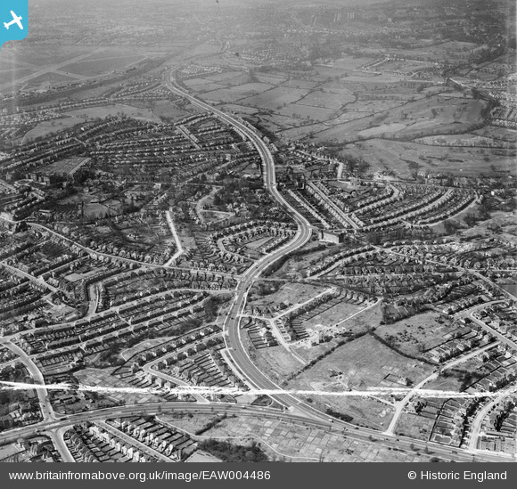
EAW004486 ENGLAND (1947). The Great North Way looking towards Hendon Aerodrome, Hendon, from the south-east, 1947. This image was marked by Aerofilms Ltd for photo editing.
© Copyright OpenStreetMap contributors and licensed by the OpenStreetMap Foundation. 2026. Cartography is licensed as CC BY-SA.
Details
| Title | [EAW004486] The Great North Way looking towards Hendon Aerodrome, Hendon, from the south-east, 1947. This image was marked by Aerofilms Ltd for photo editing. |
| Reference | EAW004486 |
| Date | 14-April-1947 |
| Link | |
| Place name | HENDON |
| Parish | |
| District | |
| Country | ENGLAND |
| Easting / Northing | 524065, 189526 |
| Longitude / Latitude | -0.20886310741963, 51.590434427098 |
| National Grid Reference | TQ241895 |
Pins

Matt Aldred edob.mattaldred.com |
Thursday 24th of August 2023 04:07:41 PM | |

Wordsmith52 |
Friday 6th of November 2015 04:11:54 PM | |

Class31 |
Saturday 22nd of March 2014 06:00:34 PM | |

Class31 |
Saturday 22nd of March 2014 05:55:15 PM | |

Class31 |
Saturday 22nd of March 2014 05:46:14 PM |


![[EAW004486] The Great North Way looking towards Hendon Aerodrome, Hendon, from the south-east, 1947. This image was marked by Aerofilms Ltd for photo editing.](http://britainfromabove.org.uk/sites/all/libraries/aerofilms-images/public/100x100/EAW/004/EAW004486.jpg)
![[EAW004485] The Great North Way looking towards Hendon Aerodrome, Hendon, from the south-east, 1947. This image was marked by Aerofilms Ltd for photo editing.](http://britainfromabove.org.uk/sites/all/libraries/aerofilms-images/public/100x100/EAW/004/EAW004485.jpg)
![[EAW004484] The Great North Way looking towards Hendon Aerodrome, Hendon, from the east, 1947](http://britainfromabove.org.uk/sites/all/libraries/aerofilms-images/public/100x100/EAW/004/EAW004484.jpg)