
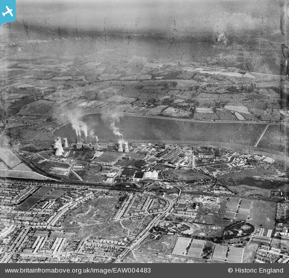
EAW004483 ENGLAND (1947). Brimsdown Industrial Estate, King George's Reservoir and environs, Brimsdown, from the west, 1947
© Copyright OpenStreetMap contributors and licensed by the OpenStreetMap Foundation. 2026. Cartography is licensed as CC BY-SA.
Nearby Images (24)
EAW004483

EPW008048

EPW008049

EAW005269

EAW005270

EPW017347

EPW017346

EPW017349

EPW017345

EPW044231

EPW017350

EPW017348

EPW017354

EPW044229

EPW044230

EPW008033

EPW008034

EPW017353

EPW008031

EPW008032

EPW008036

EPW028511

EAW005267

EPW028508

Details
| Title | [EAW004483] Brimsdown Industrial Estate, King George's Reservoir and environs, Brimsdown, from the west, 1947 |
| Reference | EAW004483 |
| Date | 14-April-1947 |
| Link | |
| Place name | BRIMSDOWN |
| Parish | |
| District | |
| Country | ENGLAND |
| Easting / Northing | 536427, 197133 |
| Longitude / Latitude | -0.027537274575867, 51.655940415025 |
| National Grid Reference | TQ364971 |
Pins
Be the first to add a comment to this image!