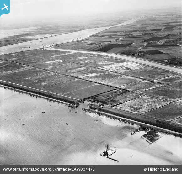
EAW004473 ENGLAND (1947). A breach in the Wash Bank undergoing emergency repairs, Crowland Fodder Lots, from the north-east, 1947
© Copyright OpenStreetMap contributors and licensed by the OpenStreetMap Foundation. 2025. Cartography is licensed as CC BY-SA.
Details
| Title | [EAW004473] A breach in the Wash Bank undergoing emergency repairs, Crowland Fodder Lots, from the north-east, 1947 |
| Reference | EAW004473 |
| Date | 16-April-1947 |
| Link | |
| Place name | CROWLAND FODDER LOTS |
| Parish | CROWLAND |
| District | |
| Country | ENGLAND |
| Easting / Northing | 523929, 312492 |
| Longitude / Latitude | -0.16596862006258, 52.69556287783 |
| National Grid Reference | TF239125 |
Pins
 jimbofin |
Sunday 11th of February 2018 02:21:15 PM |


![[EAW004473] A breach in the Wash Bank undergoing emergency repairs, Crowland Fodder Lots, from the north-east, 1947](http://britainfromabove.org.uk/sites/all/libraries/aerofilms-images/public/100x100/EAW/004/EAW004473.jpg)
![[EAW004471] A breach in the Wash Bank undergoing emergency repairs, Crowland Fodder Lots, from the south-east, 1947](http://britainfromabove.org.uk/sites/all/libraries/aerofilms-images/public/100x100/EAW/004/EAW004471.jpg)
![[EAW004469] A breach in the Wash Bank undergoing emergency repairs, Crowland Fodder Lots, from the west, 1947](http://britainfromabove.org.uk/sites/all/libraries/aerofilms-images/public/100x100/EAW/004/EAW004469.jpg)
![[EAW004468] A breach in the Wash Bank undergoing emergency repairs, Crowland Fodder Lots, from the south-west, 1947](http://britainfromabove.org.uk/sites/all/libraries/aerofilms-images/public/100x100/EAW/004/EAW004468.jpg)