
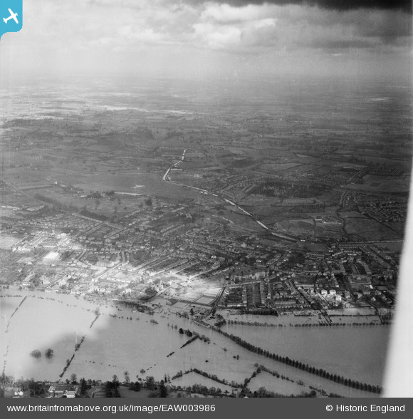
EAW003986 ENGLAND (1947). Flooding along the River Severn at the Worcester Waterworks, Worcester, from the west, 1947
© Copyright OpenStreetMap contributors and licensed by the OpenStreetMap Foundation. 2026. Cartography is licensed as CC BY-SA.
Nearby Images (6)
EAW003986

EPW000207

EPW008504

EPW008502

EPW008501

EPW008503

Details
| Title | [EAW003986] Flooding along the River Severn at the Worcester Waterworks, Worcester, from the west, 1947 |
| Reference | EAW003986 |
| Date | 21-March-1947 |
| Link | |
| Place name | WORCESTER |
| Parish | |
| District | |
| Country | ENGLAND |
| Easting / Northing | 384567, 256659 |
| Longitude / Latitude | -2.2258729851307, 52.207536762591 |
| National Grid Reference | SO846567 |
Pins

Matt Aldred edob.mattaldred.com |
Friday 14th of May 2021 03:39:55 PM | |

Cowshed |
Friday 15th of November 2013 09:38:24 PM |