
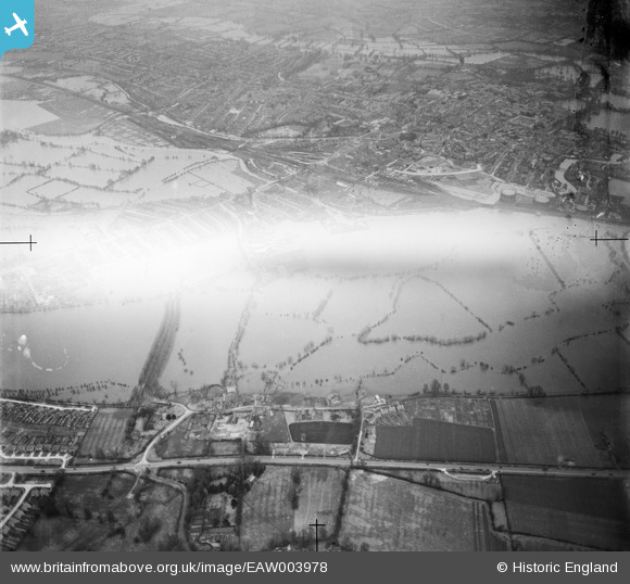
EAW003978 ENGLAND (1947). Flooding around New Botley and North Hinksey, New Botley, from the south-west, 1947. This image has been produced from a damaged negative.
© Copyright OpenStreetMap contributors and licensed by the OpenStreetMap Foundation. 2026. Cartography is licensed as CC BY-SA.
Nearby Images (2)
EAW003978

EAW003951

Details
| Title | [EAW003978] Flooding around New Botley and North Hinksey, New Botley, from the south-west, 1947. This image has been produced from a damaged negative. |
| Reference | EAW003978 |
| Date | 20-March-1947 |
| Link | |
| Place name | NEW BOTLEY |
| Parish | |
| District | |
| Country | ENGLAND |
| Easting / Northing | 449841, 205503 |
| Longitude / Latitude | -1.278001832965, 51.74555220013 |
| National Grid Reference | SP498055 |
Pins
Be the first to add a comment to this image!