
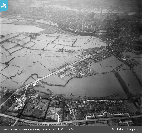
EAW003977 ENGLAND (1947). Flooding around New Botley and environs, New Botley, from the south-west, 1947
© Copyright OpenStreetMap contributors and licensed by the OpenStreetMap Foundation. 2026. Cartography is licensed as CC BY-SA.
Nearby Images (13)
EAW003977

EAW029586

EAW029587

EAW029593

EAW029589

EAW029588

EAW029592

EAW029591

EAW029590

EAW003953

EPW047762

EPW047760

EPW047764

Details
| Title | [EAW003977] Flooding around New Botley and environs, New Botley, from the south-west, 1947 |
| Reference | EAW003977 |
| Date | 20-March-1947 |
| Link | |
| Place name | NEW BOTLEY |
| Parish | |
| District | |
| Country | ENGLAND |
| Easting / Northing | 449300, 206025 |
| Longitude / Latitude | -1.2857640929345, 51.750293601074 |
| National Grid Reference | SP493060 |
Pins
Be the first to add a comment to this image!