
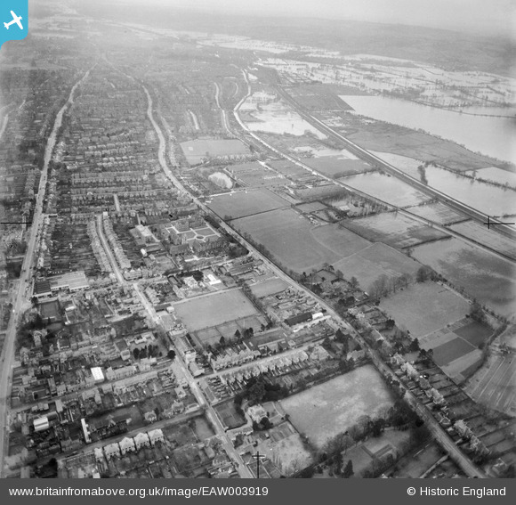
EAW003919 ENGLAND (1947). Woodstock Road and environs with flooding at Port Meadow, Summertown, from the north, 1947
© Copyright OpenStreetMap contributors and licensed by the OpenStreetMap Foundation. 2026. Cartography is licensed as CC BY-SA.
Nearby Images (3)
EAW003919

EPW022541

EAW003920

Details
| Title | [EAW003919] Woodstock Road and environs with flooding at Port Meadow, Summertown, from the north, 1947 |
| Reference | EAW003919 |
| Date | 20-March-1947 |
| Link | |
| Place name | SUMMERTOWN |
| Parish | |
| District | |
| Country | ENGLAND |
| Easting / Northing | 450497, 209213 |
| Longitude / Latitude | -1.2679605186234, 51.778851431345 |
| National Grid Reference | SP505092 |
Pins

ndaisley |
Tuesday 10th of September 2013 05:36:12 PM | |
|
ndaisley |
Tuesday 10th of September 2013 05:28:03 PM | |
Also 'legless' fighter pilot Douglas Bader. |
John_Hope |
Wednesday 8th of January 2025 11:58:09 AM |