
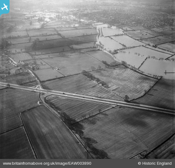
EAW003890 ENGLAND (1947). The Northern Bypass Road and flooding by Marston Ferry and environs, Marston, from the north-east, 1947
© Copyright OpenStreetMap contributors and licensed by the OpenStreetMap Foundation. 2026. Cartography is licensed as CC BY-SA.
Nearby Images (3)
EAW003890

EAW050081

EAW003889

Details
| Title | [EAW003890] The Northern Bypass Road and flooding by Marston Ferry and environs, Marston, from the north-east, 1947 |
| Reference | EAW003890 |
| Date | 20-March-1947 |
| Link | |
| Place name | MARSTON |
| Parish | OLD MARSTON |
| District | |
| Country | ENGLAND |
| Easting / Northing | 452294, 209459 |
| Longitude / Latitude | -1.2418753093626, 51.780898212809 |
| National Grid Reference | SP523095 |
Pins
Be the first to add a comment to this image!