
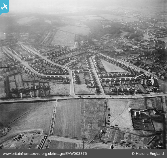
EAW003876 ENGLAND (1947). The Risinghurst Estate, Risinghurst, 1947
© Copyright OpenStreetMap contributors and licensed by the OpenStreetMap Foundation. 2026. Cartography is licensed as CC BY-SA.
Nearby Images (3)
EAW003876

EAW003981

EAW003875

Details
| Title | [EAW003876] The Risinghurst Estate, Risinghurst, 1947 |
| Reference | EAW003876 |
| Date | 20-March-1947 |
| Link | |
| Place name | RISINGHURST |
| Parish | RISINGHURST AND SANDHILLS |
| District | |
| Country | ENGLAND |
| Easting / Northing | 455824, 207279 |
| Longitude / Latitude | -1.1910554802795, 51.760956309306 |
| National Grid Reference | SP558073 |
Pins
Be the first to add a comment to this image!