
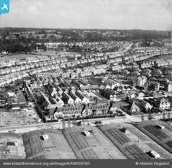
EAW003760 ENGLAND (1947). The Cellon Chemical Works and environs, Kingston Upon Thames, from the west, 1947
© Copyright OpenStreetMap contributors and licensed by the OpenStreetMap Foundation. 2026. Cartography is licensed as CC BY-SA.
Nearby Images (20)
EAW003760

EAW003759

EAW003766

EAW003762

EPW022854

EAW003755

EAW003757

EAW003761

EAW003765

EAW003763

EAW003767

EAW003758

EAW003756

EAW003764

EAW003754

EPW055958

EPW055954

EPW055955

EPW055956

EPW055953

Details
| Title | [EAW003760] The Cellon Chemical Works and environs, Kingston Upon Thames, from the west, 1947 |
| Reference | EAW003760 |
| Date | 18-March-1947 |
| Link | |
| Place name | KINGSTON UPON THAMES |
| Parish | |
| District | |
| Country | ENGLAND |
| Easting / Northing | 517821, 171323 |
| Longitude / Latitude | -0.30504843982762, 51.428156668691 |
| National Grid Reference | TQ178713 |
Pins

Sparky |
Thursday 28th of September 2017 09:15:38 PM |