
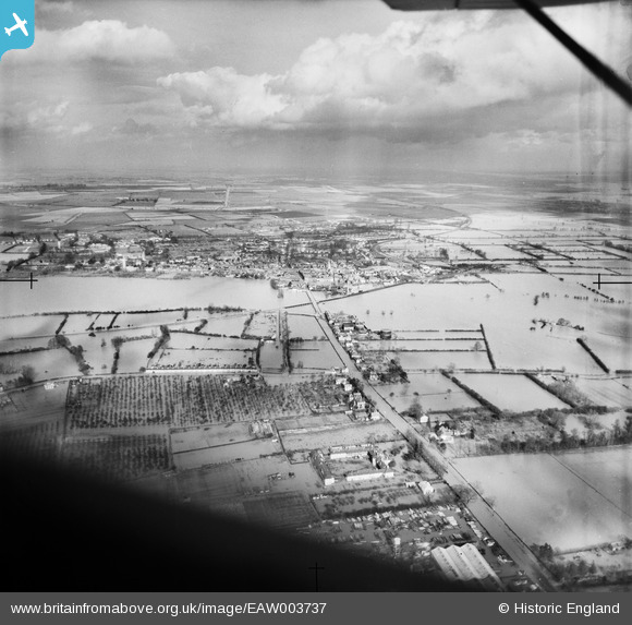
EAW003737 ENGLAND (1947). Extensive flooding surrounding St Ives, Hemingford Grey, from the south-west, 1947
© Copyright OpenStreetMap contributors and licensed by the OpenStreetMap Foundation. 2026. Cartography is licensed as CC BY-SA.
Nearby Images (6)
EAW003737

EAW007468

EAW007467

EAW007466

EAW007469

EAW007465

Details
| Title | [EAW003737] Extensive flooding surrounding St Ives, Hemingford Grey, from the south-west, 1947 |
| Reference | EAW003737 |
| Date | 3-March-1947 |
| Link | |
| Place name | HEMINGFORD GREY |
| Parish | HEMINGFORD GREY |
| District | |
| Country | ENGLAND |
| Easting / Northing | 530792, 270455 |
| Longitude / Latitude | -0.080991374867615, 52.316209262974 |
| National Grid Reference | TL308705 |
Pins

Matt Aldred edob.mattaldred.com |
Sunday 8th of December 2024 09:05:48 PM | |
|
Matt Aldred edob.mattaldred.com |
Friday 3rd of May 2019 03:53:26 PM |