
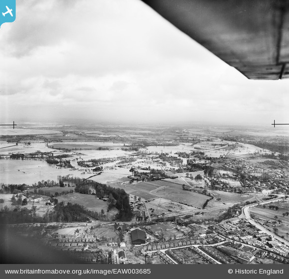
EAW003685 ENGLAND (1947). The River Thames in flood surrounding the Chertsey Meads and Hamhaugh Island, Hamm Moor, from the south-west, 1947
© Copyright OpenStreetMap contributors and licensed by the OpenStreetMap Foundation. 2026. Cartography is licensed as CC BY-SA.
Details
| Title | [EAW003685] The River Thames in flood surrounding the Chertsey Meads and Hamhaugh Island, Hamm Moor, from the south-west, 1947 |
| Reference | EAW003685 |
| Date | 18-March-1947 |
| Link | |
| Place name | HAMM MOOR |
| Parish | |
| District | |
| Country | ENGLAND |
| Easting / Northing | 506301, 165103 |
| Longitude / Latitude | -0.47257031303081, 51.374520896286 |
| National Grid Reference | TQ063651 |
Pins

Matt Aldred edob.mattaldred.com |
Wednesday 31st of July 2024 03:57:47 PM | |

Christopher Runciman |
Friday 27th of October 2023 09:19:06 AM | |
|
bumblee |
Wednesday 7th of January 2015 03:17:01 PM | |
|
bumblee |
Wednesday 7th of January 2015 03:13:52 PM | |
|
cptpies |
Friday 20th of December 2013 10:49:29 AM |
User Comment Contributions

WWII HAA Battery, Woburn Park. |
cptpies |
Friday 20th of December 2013 10:49:48 AM |