
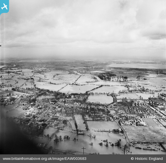
EAW003683 ENGLAND (1947). The River Thames in flood surrounding the town, Chertsey, from the south-west, 1947
© Copyright OpenStreetMap contributors and licensed by the OpenStreetMap Foundation. 2026. Cartography is licensed as CC BY-SA.
Nearby Images (3)
EAW003683

EPW023376

EPW026272

Details
| Title | [EAW003683] The River Thames in flood surrounding the town, Chertsey, from the south-west, 1947 |
| Reference | EAW003683 |
| Date | 18-March-1947 |
| Link | |
| Place name | CHERTSEY |
| Parish | |
| District | |
| Country | ENGLAND |
| Easting / Northing | 504352, 166730 |
| Longitude / Latitude | -0.50008681179735, 51.389508625535 |
| National Grid Reference | TQ044667 |
Pins

Martin L |
Saturday 27th of April 2019 03:38:37 PM | |
|
bumblee |
Wednesday 7th of January 2015 03:01:22 PM | |
|
bumblee |
Wednesday 7th of January 2015 03:00:37 PM | |
|
bumblee |
Wednesday 7th of January 2015 02:58:24 PM | |
|
bumblee |
Wednesday 7th of January 2015 02:57:41 PM |