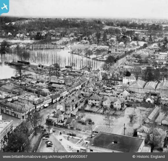
EAW003667 ENGLAND (1947). Bridge Road, Maidenhead, from the south-west, 1947
© Copyright OpenStreetMap contributors and licensed by the OpenStreetMap Foundation. 2026. Cartography is licensed as CC BY-SA.
Details
| Title | [EAW003667] Bridge Road, Maidenhead, from the south-west, 1947 |
| Reference | EAW003667 |
| Date | March-1947 |
| Link | |
| Place name | MAIDENHEAD |
| Parish | |
| District | |
| Country | ENGLAND |
| Easting / Northing | 489217, 181247 |
| Longitude / Latitude | -0.71390446410878, 51.522603073045 |
| National Grid Reference | SU892812 |
Pins

spikey1810 |
Friday 11th of October 2024 02:43:44 PM |


![[EAW003667] Bridge Road, Maidenhead, from the south-west, 1947](http://britainfromabove.org.uk/sites/all/libraries/aerofilms-images/public/100x100/EAW/003/EAW003667.jpg)
![[EPW022622] Maidenhead and environs, Maidenhead, 1928](http://britainfromabove.org.uk/sites/all/libraries/aerofilms-images/public/100x100/EPW/022/EPW022622.jpg)