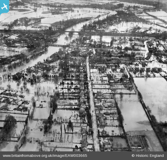
EAW003665 ENGLAND (1947). Extensive flooding around Ray Park Avenue, Maidenhead, 1947
© Copyright OpenStreetMap contributors and licensed by the OpenStreetMap Foundation. 2026. Cartography is licensed as CC BY-SA.
Details
| Title | [EAW003665] Extensive flooding around Ray Park Avenue, Maidenhead, 1947 |
| Reference | EAW003665 |
| Date | March-1947 |
| Link | |
| Place name | MAIDENHEAD |
| Parish | |
| District | |
| Country | ENGLAND |
| Easting / Northing | 489904, 181757 |
| Longitude / Latitude | -0.70387363713483, 51.52707908987 |
| National Grid Reference | SU899818 |
Pins
Be the first to add a comment to this image!
User Comment Contributions
Should be Ray Park Avenue not Hay Park Avenue |

32110 |
Friday 23rd of August 2013 02:31:00 PM |
Whoops! Thank you for pointing out my mistake - I'll make sure the caption is updated when the next website upload takes place. Best wishes Laura Maddison Britain from Above Cataloguer |

Laura Maddison |
Friday 23rd of August 2013 02:31:00 PM |


![[EAW003665] Extensive flooding around Ray Park Avenue, Maidenhead, 1947](http://britainfromabove.org.uk/sites/all/libraries/aerofilms-images/public/100x100/EAW/003/EAW003665.jpg)
![[EAW026483] Maidenhead Bridge, the River Thames and environs, Maidenhead, from the north-west, 1949](http://britainfromabove.org.uk/sites/all/libraries/aerofilms-images/public/100x100/EAW/026/EAW026483.jpg)
![[EAW034759] The gardens of Green Hedges to The Twelfth House on Ray Mead Road in flood, Maidenhead, 1951](http://britainfromabove.org.uk/sites/all/libraries/aerofilms-images/public/100x100/EAW/034/EAW034759.jpg)
![[EAW034758] The gardens of Green Hedges to The Twelfth House on Ray Mead Road in flood, Maidenhead, 1951](http://britainfromabove.org.uk/sites/all/libraries/aerofilms-images/public/100x100/EAW/034/EAW034758.jpg)