
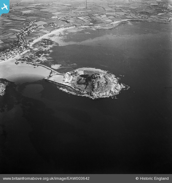
EAW003642 ENGLAND (1947). St Michael's Mount and Mount's Bay, St Michael's Mount, from the west, 1947
© Copyright OpenStreetMap contributors and licensed by the OpenStreetMap Foundation. 2026. Cartography is licensed as CC BY-SA.
Nearby Images (14)
EAW003642

EAW015143

EAW004871

EAW004868

EAW007543

EAW004869

EAW007542

EAW003638

EAW007548

EPW021764

EAW007547

EAW005971

EAW007540

EPW059661

Details
| Title | [EAW003642] St Michael's Mount and Mount's Bay, St Michael's Mount, from the west, 1947 |
| Reference | EAW003642 |
| Date | March-1947 |
| Link | |
| Place name | ST MICHAEL'S MOUNT |
| Parish | ST. MICHAEL'S MOUNT |
| District | |
| Country | ENGLAND |
| Easting / Northing | 151197, 29959 |
| Longitude / Latitude | -5.4808044404965, 50.116850343716 |
| National Grid Reference | SW512300 |
Pins
Be the first to add a comment to this image!