
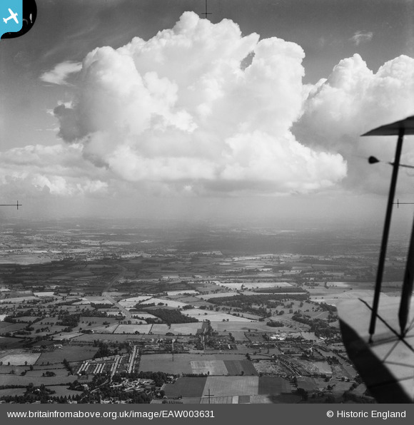
EAW003631 ENGLAND (1947). The Colne Valley, London Colney, from the south-west, 1947
© Copyright OpenStreetMap contributors and licensed by the OpenStreetMap Foundation. 2026. Cartography is licensed as CC BY-SA.
Nearby Images (2)
EAW003631

EPW015788

Details
| Title | [EAW003631] The Colne Valley, London Colney, from the south-west, 1947 |
| Reference | EAW003631 |
| Date | March-1947 |
| Link | |
| Place name | LONDON COLNEY |
| Parish | LONDON COLNEY |
| District | |
| Country | ENGLAND |
| Easting / Northing | 517453, 203981 |
| Longitude / Latitude | -0.2994175483356, 51.721777967809 |
| National Grid Reference | TL175040 |
Pins

Downloader141 |
Friday 17th of October 2025 11:53:33 PM | |

John W |
Friday 15th of May 2020 11:49:42 AM | |
|
John W |
Thursday 9th of March 2017 09:44:50 PM | |
|
John W |
Thursday 9th of March 2017 09:43:52 PM | |
|
John W |
Thursday 9th of March 2017 09:37:12 PM | |
|
John W |
Thursday 9th of March 2017 09:26:25 PM | |
|
John W |
Thursday 9th of March 2017 09:25:35 PM | |
|
John W |
Thursday 9th of March 2017 09:19:17 PM | |
|
John W |
Thursday 9th of March 2017 09:17:59 PM | |
|
John W |
Thursday 9th of March 2017 09:16:47 PM | |
|
John W |
Thursday 9th of March 2017 09:15:01 PM | |
|
John W |
Thursday 9th of March 2017 09:13:25 PM | |
|
John W |
Thursday 9th of March 2017 09:09:38 PM | |
|
John W |
Thursday 9th of March 2017 09:00:50 PM | |
|
John W |
Thursday 9th of March 2017 09:00:17 PM | |
|
John W |
Thursday 9th of March 2017 08:59:45 PM |
User Comment Contributions
This photo is before the London Colney Bypass was built in the mid-1950s, so The High Street and Barnet Road were at this time the route of the A6, the road from London to Holyhead. |
John W |
Thursday 9th of March 2017 09:29:17 PM |