
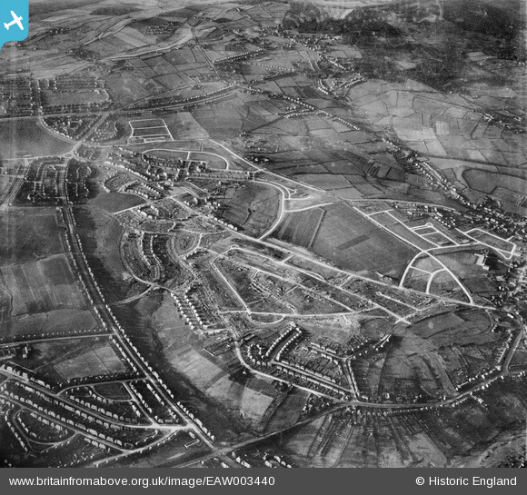
EAW003440 ENGLAND (1946). Housing estate under construction to the north of Deerlands Avenue, Parson Cross, 1946
© Copyright OpenStreetMap contributors and licensed by the OpenStreetMap Foundation. 2026. Cartography is licensed as CC BY-SA.
Nearby Images (2)
EAW003440

EAW003441

Details
| Title | [EAW003440] Housing estate under construction to the north of Deerlands Avenue, Parson Cross, 1946 |
| Reference | EAW003440 |
| Date | 4-December-1946 |
| Link | |
| Place name | PARSON CROSS |
| Parish | |
| District | |
| Country | ENGLAND |
| Easting / Northing | 435159, 393015 |
| Longitude / Latitude | -1.4707453800414, 53.432487772364 |
| National Grid Reference | SK352930 |
Pins

redmist |
Thursday 17th of January 2019 08:18:56 PM |