
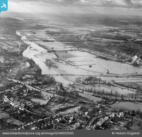
EAW003393 ENGLAND (1946). The River Trent in flood from St Peter's Church to the Railway Viaduct, Stapenhill, from the north-east, 1946
© Copyright OpenStreetMap contributors and licensed by the OpenStreetMap Foundation. 2026. Cartography is licensed as CC BY-SA.
Details
| Title | [EAW003393] The River Trent in flood from St Peter's Church to the Railway Viaduct, Stapenhill, from the north-east, 1946 |
| Reference | EAW003393 |
| Date | 26-November-1946 |
| Link | |
| Place name | STAPENHILL |
| Parish | STAPENHILL |
| District | |
| Country | ENGLAND |
| Easting / Northing | 425524, 322175 |
| Longitude / Latitude | -1.6214141914139, 52.796201706403 |
| National Grid Reference | SK255222 |
Pins

Matt Aldred edob.mattaldred.com |
Monday 8th of March 2021 07:58:22 PM | |
|
Matt Aldred edob.mattaldred.com |
Monday 8th of March 2021 07:58:05 PM | |

cptpies |
Wednesday 27th of November 2019 12:35:12 PM | |
|
jrussill |
Wednesday 24th of December 2014 12:42:51 PM |
User Comment Contributions

WW2 Pillbox |
jrussill |
Wednesday 24th of December 2014 12:43:34 PM |