
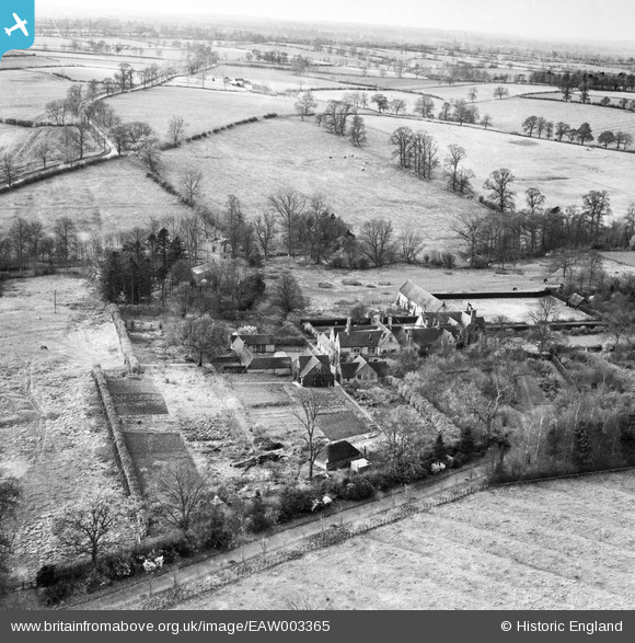
EAW003365 ENGLAND (1946). The Manor House and the surrounding countryside, Winwick, from the north-east, 1946
© Copyright OpenStreetMap contributors and licensed by the OpenStreetMap Foundation. 2026. Cartography is licensed as CC BY-SA.
Nearby Images (11)
EAW003365

EAW003363

EAW003366

EAW003361A

EAW003361

EAW003367

EAW003370

EAW003369

EAW003362

EAW003368

EAW003364

Details
| Title | [EAW003365] The Manor House and the surrounding countryside, Winwick, from the north-east, 1946 |
| Reference | EAW003365 |
| Date | 26-November-1946 |
| Link | |
| Place name | WINWICK |
| Parish | WINWICK |
| District | |
| Country | ENGLAND |
| Easting / Northing | 462652, 273990 |
| Longitude / Latitude | -1.0798811356431, 52.359999326479 |
| National Grid Reference | SP627740 |
Pins
Be the first to add a comment to this image!