
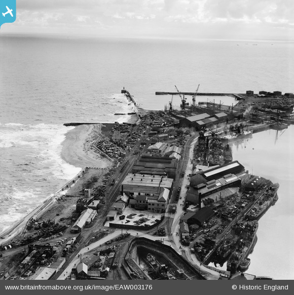
EAW003176 ENGLAND (1946). The North Eastern Marine Engineering Company Works, Sunderland, from the north-west, 1946
© Copyright OpenStreetMap contributors and licensed by the OpenStreetMap Foundation. 2026. Cartography is licensed as CC BY-SA.
Nearby Images (20)
EAW003176

EPW051128

EAW003171

EAW003170

EAW003183

EAW003182

EAW003177

EPW020546

EAW003184

EAW003172

EAW003180

EAW003178

EAW003175

EPW020539

EPW020536

EAW003179

EPW020533

EAW003173

EAW001017

EAW003181

Details
| Title | [EAW003176] The North Eastern Marine Engineering Company Works, Sunderland, from the north-west, 1946 |
| Reference | EAW003176 |
| Date | 23-October-1946 |
| Link | |
| Place name | SUNDERLAND |
| Parish | |
| District | |
| Country | ENGLAND |
| Easting / Northing | 441153, 557646 |
| Longitude / Latitude | -1.3580097140972, 54.911742399512 |
| National Grid Reference | NZ412576 |
Pins

redmist |
Saturday 26th of September 2020 12:25:53 PM | |
|
redmist |
Saturday 26th of September 2020 12:24:34 PM | |
|
redmist |
Monday 18th of March 2019 02:58:09 PM | |
|
Al |
Tuesday 7th of January 2014 09:54:23 PM | |
|
Al |
Tuesday 7th of January 2014 09:53:49 PM |
User Comment Contributions

shows pillbox e21704 |
Al |
Tuesday 7th of January 2014 09:54:58 PM |