
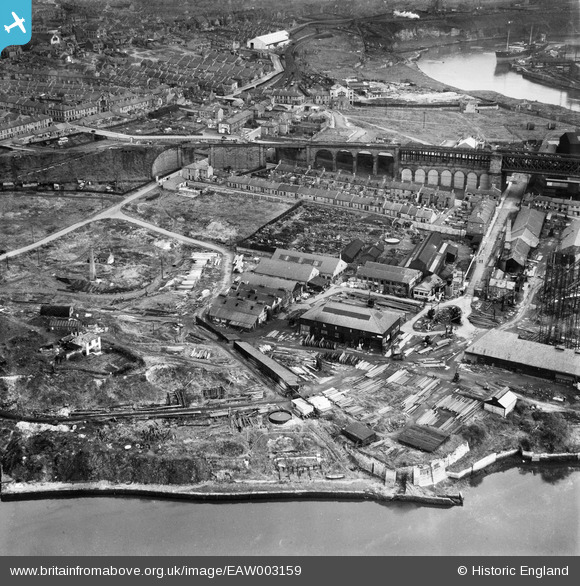
EAW003159 ENGLAND (1946). The Richardsons, Westgarth and Co Shipbuilding Yard (G. Clark Ltd), Sunderland, 1946
© Copyright OpenStreetMap contributors and licensed by the OpenStreetMap Foundation. 2026. Cartography is licensed as CC BY-SA.
Nearby Images (14)
EAW003159
, Sunderland, 1946")
EPW006529

EAW003156
 alongside Queen Alexandra Bridge, Sunderland, 1946")
EAW003158
 and the surrounding residential area, Sunderland, from the south-west, 1946")
EAW003161
, Glasshouse Hill and the Castletown Shipbuilding Yard, Sunderland, 1946")
EAW003152
, Queen Alexandra Bridge and the surrounding residential area, Sunderland, 1946")
EAW003160
 and the Pallion Shipbuilding Yard, Sunderland, 1946")
EPW006526

EAW001035

EPW006528

EAW003151
 alongside Queen Alexandra Bridge, Sunderland, 1946")
EAW003157
 and the Pallion Shipbuilding Yard, Sunderland, 1946")
EAW003153
, Queen Alexandra Bridge and the surrounding industrial area, Sunderland, 1946")
EAW003165
, Sunderland, 1946")
Details
| Title | [EAW003159] The Richardsons, Westgarth and Co Shipbuilding Yard (G. Clark Ltd), Sunderland, 1946 |
| Reference | EAW003159 |
| Date | 23-October-1946 |
| Link | |
| Place name | SUNDERLAND |
| Parish | |
| District | |
| Country | ENGLAND |
| Easting / Northing | 437985, 558063 |
| Longitude / Latitude | -1.4073726585113, 54.91574091748 |
| National Grid Reference | NZ380581 |
Pins

redmist |
Saturday 26th of September 2020 11:18:24 AM | |
|
redmist |
Saturday 26th of September 2020 11:18:00 AM | |
|
redmist |
Saturday 26th of September 2020 11:17:23 AM | |
|
redmist |
Saturday 26th of October 2019 11:58:52 AM | |
|
redmist |
Saturday 26th of October 2019 11:58:17 AM | |
|
kevin n |
Thursday 9th of January 2014 05:47:13 PM |