
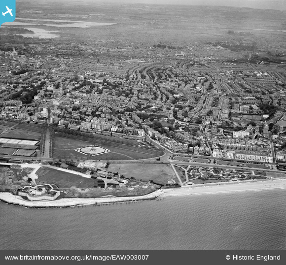
EAW003007 ENGLAND (1946). Southsea Castle, East Battery, the bandstand and the town, Southsea, from the south, 1946
© Copyright OpenStreetMap contributors and licensed by the OpenStreetMap Foundation. 2026. Cartography is licensed as CC BY-SA.
Nearby Images (5)
EAW003007

EPW024691

EPW039677

EAW003009

EAW003006

Details
| Title | [EAW003007] Southsea Castle, East Battery, the bandstand and the town, Southsea, from the south, 1946 |
| Reference | EAW003007 |
| Date | 3-October-1946 |
| Link | |
| Place name | SOUTHSEA |
| Parish | SOUTHSEA |
| District | |
| Country | ENGLAND |
| Easting / Northing | 464582, 98217 |
| Longitude / Latitude | -1.0838719489135, 50.779363246582 |
| National Grid Reference | SZ646982 |
Pins

Class31 |
Monday 16th of February 2015 02:49:58 PM | |

5tumb1ebum |
Friday 25th of July 2014 10:26:04 PM | |
|
hoppy |
Friday 4th of April 2014 05:42:07 AM | |
|
hoppy |
Friday 4th of April 2014 05:40:35 AM | |
|
hoppy |
Friday 4th of April 2014 05:37:44 AM | |
|
elanbretta |
Friday 20th of December 2013 03:02:06 PM | |
|
elanbretta |
Friday 20th of December 2013 02:59:40 PM | |
|
elanbretta |
Friday 20th of December 2013 02:59:04 PM | |
|
Martin |
Wednesday 13th of November 2013 11:28:13 PM | |
|
Martin |
Wednesday 13th of November 2013 11:27:15 PM |
