
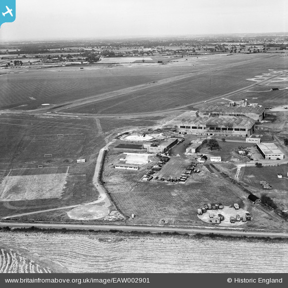
EAW002901 ENGLAND (1946). RAF Horsham St Faith Airfield (Norwich Airport), Norwich, from the south-east, 1946
© Copyright OpenStreetMap contributors and licensed by the OpenStreetMap Foundation. 2026. Cartography is licensed as CC BY-SA.
Nearby Images (6)
EAW002901
, Norwich, from the south-east, 1946")
EAW002902
, Norwich, from the south, 1946")
EAW002903
, Norwich, from the south-east, 1946")
EAW001960

EAW001955

EAW002904

Details
| Title | [EAW002901] RAF Horsham St Faith Airfield (Norwich Airport), Norwich, from the south-east, 1946 |
| Reference | EAW002901 |
| Date | 1-October-1946 |
| Link | |
| Place name | NORWICH |
| Parish | |
| District | |
| Country | ENGLAND |
| Easting / Northing | 621979, 312622 |
| Longitude / Latitude | 1.2831443680203, 52.665432692682 |
| National Grid Reference | TG220126 |
Pins

redmist |
Thursday 11th of March 2021 08:48:57 PM | |
|
redmist |
Thursday 11th of March 2021 07:52:20 PM | |

Matt Aldred edob.mattaldred.com |
Tuesday 24th of November 2020 10:39:24 PM | |
|
Matt Aldred edob.mattaldred.com |
Tuesday 24th of November 2020 10:39:00 PM | |
|
Matt Aldred edob.mattaldred.com |
Tuesday 24th of November 2020 09:30:29 PM | |

Sparky |
Saturday 16th of September 2017 03:41:29 PM | |
|
Graham Yaxley |
Thursday 18th of December 2014 10:27:39 PM | |
|
Graham Yaxley |
Thursday 18th of December 2014 10:26:47 PM | |
|
Graham Yaxley |
Thursday 18th of December 2014 10:23:41 PM |