
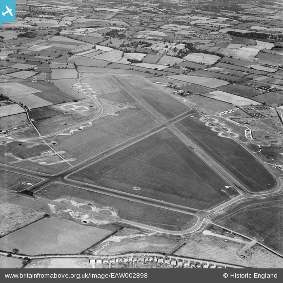
EAW002898 ENGLAND (1946). RAF Horsham St Faith Airfield (Norwich Airport), Norwich, 1946
© Copyright OpenStreetMap contributors and licensed by the OpenStreetMap Foundation. 2026. Cartography is licensed as CC BY-SA.
Nearby Images (3)
EAW002898
, Norwich, 1946")
EAW002896
, Norwich, 1946")
EAW002899
, Norwich, 1946")
Details
| Title | [EAW002898] RAF Horsham St Faith Airfield (Norwich Airport), Norwich, 1946 |
| Reference | EAW002898 |
| Date | 1-October-1946 |
| Link | |
| Place name | NORWICH |
| Parish | |
| District | |
| Country | ENGLAND |
| Easting / Northing | 621900, 313759 |
| Longitude / Latitude | 1.2827436309714, 52.67567069049 |
| National Grid Reference | TG219138 |
Pins

Matt Aldred edob.mattaldred.com |
Sunday 16th of February 2025 12:18:13 PM | |
|
Matt Aldred edob.mattaldred.com |
Sunday 16th of February 2025 12:17:29 PM | |
|
Matt Aldred edob.mattaldred.com |
Wednesday 6th of March 2024 07:46:32 PM | |

sum0 |
Wednesday 15th of April 2020 09:16:11 PM | |
|
sum0 |
Wednesday 15th of April 2020 09:15:22 PM | |
|
sum0 |
Wednesday 15th of April 2020 09:15:09 PM | |
|
Graham Yaxley |
Monday 5th of January 2015 11:21:43 PM | |
|
Graham Yaxley |
Saturday 27th of December 2014 10:18:07 PM | |
|
Graham Yaxley |
Saturday 27th of December 2014 10:15:44 PM | |
|
Graham Yaxley |
Saturday 27th of December 2014 10:12:36 PM |