
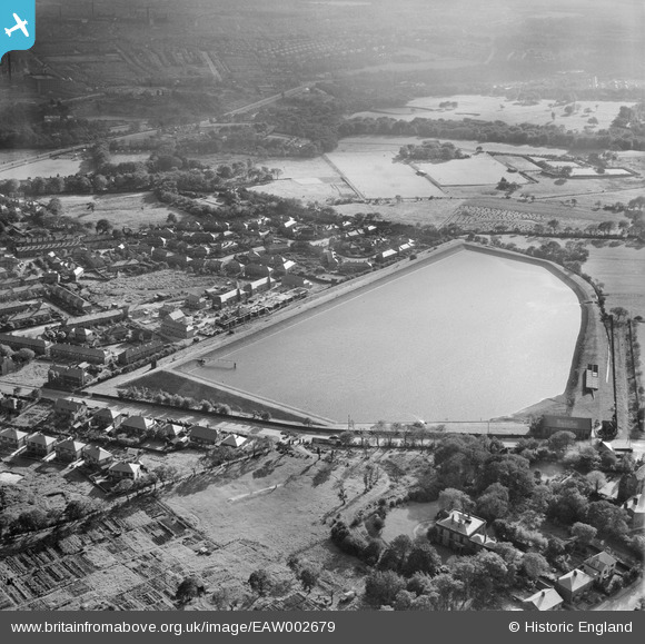
EAW002679 ENGLAND (1946). Sweetlove's Reservoir (Bolton Corporation Water Works), Sharples, 1946
© Copyright OpenStreetMap contributors and licensed by the OpenStreetMap Foundation. 2026. Cartography is licensed as CC BY-SA.
Nearby Images (2)
EAW002679
, Sharples, 1946")
EAW002678
, Sharples, from the south-west, 1946")
Details
| Title | [EAW002679] Sweetlove's Reservoir (Bolton Corporation Water Works), Sharples, 1946 |
| Reference | EAW002679 |
| Date | 11-September-1946 |
| Link | |
| Place name | SHARPLES |
| Parish | |
| District | |
| Country | ENGLAND |
| Easting / Northing | 370982, 412260 |
| Longitude / Latitude | -2.4385994278295, 53.605858139334 |
| National Grid Reference | SD710123 |
Pins

IanB |
Friday 11th of November 2016 05:06:16 PM | |
|
IanB |
Friday 11th of November 2016 05:04:37 PM | |
|
IanB |
Friday 11th of November 2016 04:57:34 PM | |
|
IanB |
Friday 11th of November 2016 04:50:14 PM | |
|
thomasknight |
Friday 27th of March 2015 10:09:41 PM | |
|
thomasknight |
Friday 27th of March 2015 10:06:27 PM | |
|
thomasknight |
Friday 27th of March 2015 10:03:59 PM | |
|
thomasknight |
Friday 27th of March 2015 10:03:08 PM | |
|
thomasknight |
Friday 27th of March 2015 10:01:59 PM | |
|
thomasknight |
Friday 27th of March 2015 09:56:16 PM | |
|
thomasknight |
Friday 27th of March 2015 09:55:43 PM | |
|
thomasknight |
Friday 27th of March 2015 09:55:19 PM | |
|
thomasknight |
Friday 27th of March 2015 09:54:11 PM |