
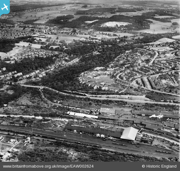
EAW002624 ENGLAND (1946). The Kirkstall Iron and Steel Forge, Hawksworth Wood and the surrounding area, Bramley Fall, 1946
© Copyright OpenStreetMap contributors and licensed by the OpenStreetMap Foundation. 2026. Cartography is licensed as CC BY-SA.
Nearby Images (4)
EAW002624

EAW002625

EAW002628

EAW002629

Details
| Title | [EAW002624] The Kirkstall Iron and Steel Forge, Hawksworth Wood and the surrounding area, Bramley Fall, 1946 |
| Reference | EAW002624 |
| Date | 19-September-1946 |
| Link | |
| Place name | BRAMLEY FALL |
| Parish | |
| District | |
| Country | ENGLAND |
| Easting / Northing | 424766, 436938 |
| Longitude / Latitude | -1.6236920097735, 53.827905514098 |
| National Grid Reference | SE248369 |
Pins

Matt Aldred edob.mattaldred.com |
Tuesday 1st of February 2022 09:59:25 PM | |
|
Matt Aldred edob.mattaldred.com |
Tuesday 1st of February 2022 09:59:08 PM | |

redmist |
Wednesday 10th of November 2021 10:47:42 PM | |
|
redmist |
Wednesday 10th of November 2021 09:05:48 PM | |
|
redmist |
Wednesday 10th of November 2021 01:07:54 PM | |
|
redmist |
Friday 31st of July 2020 09:13:05 PM | |

Sparky |
Saturday 16th of September 2017 09:53:38 PM | |
|
Malcolm |
Tuesday 18th of February 2014 12:42:49 PM |