
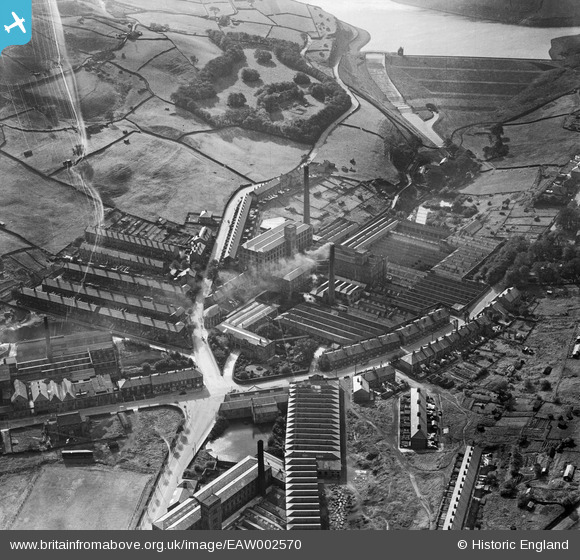
EAW002570 ENGLAND (1946). Bank Bottom Woollen Mills, Marsden, 1946
© Copyright OpenStreetMap contributors and licensed by the OpenStreetMap Foundation. 2026. Cartography is licensed as CC BY-SA.
Nearby Images (14)
EAW002570

EAW002571

EAW002564

EAW002558

EAW002566

EPW016150

EAW002568

EPW016151

EAW002567

EAW002556

EAW002572

EAW002557

EAW002560

EAW002559

Details
| Title | [EAW002570] Bank Bottom Woollen Mills, Marsden, 1946 |
| Reference | EAW002570 |
| Date | 16-September-1946 |
| Link | |
| Place name | MARSDEN |
| Parish | |
| District | |
| Country | ENGLAND |
| Easting / Northing | 404812, 411154 |
| Longitude / Latitude | -1.927283825547, 53.596697552631 |
| National Grid Reference | SE048112 |
Pins

redmist |
Monday 18th of November 2019 08:52:05 PM | |
|
MarsdenEnthusiast |
Tuesday 2nd of August 2016 03:18:49 AM |