
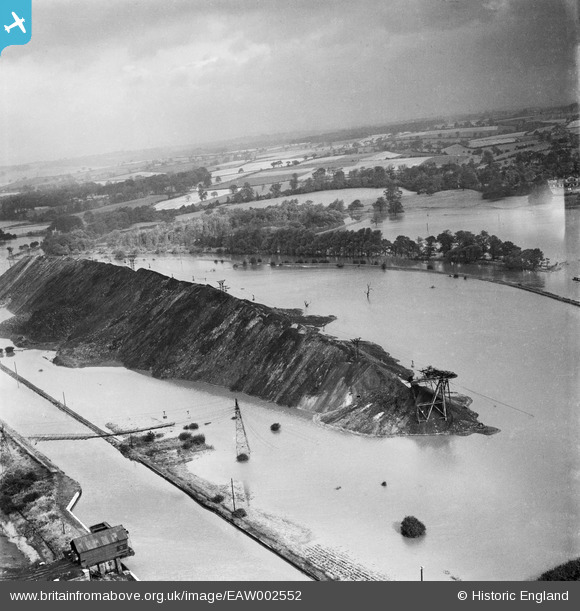
EAW002552 ENGLAND (1946). A spoil tip surrounded by flood waters between the Aire & Calder Navigation and the River Aire, Woodlesford, from the south, 1946
© Copyright OpenStreetMap contributors and licensed by the OpenStreetMap Foundation. 2026. Cartography is licensed as CC BY-SA.
Nearby Images (3)
EAW002552

EAW002553

EAW002532

Details
| Title | [EAW002552] A spoil tip surrounded by flood waters between the Aire & Calder Navigation and the River Aire, Woodlesford, from the south, 1946 |
| Reference | EAW002552 |
| Date | 21-September-1946 |
| Link | |
| Place name | WOODLESFORD |
| Parish | |
| District | |
| Country | ENGLAND |
| Easting / Northing | 437732, 428693 |
| Longitude / Latitude | -1.4276982242919, 53.753015035962 |
| National Grid Reference | SE377287 |
Pins

Class31 |
Friday 6th of September 2013 06:30:06 AM |