
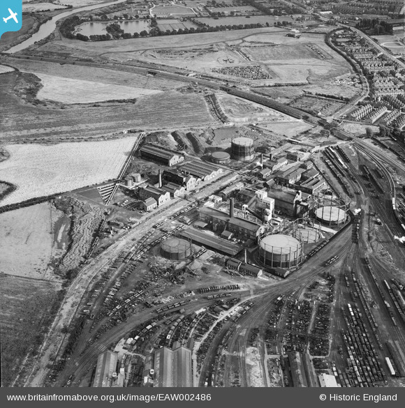
EAW002486 ENGLAND (1946). Derby Gas Light Co Gas Works, Derby, 1946
© Copyright OpenStreetMap contributors and licensed by the OpenStreetMap Foundation. 2026. Cartography is licensed as CC BY-SA.
Nearby Images (16)
EAW002486

EAW002485

EPW047199

EAW002482

EPW047204

EPW047205

EPW017037

EAW002488

EPW047200

EAW002487

EPW017036

EPW047202

EPW047201

EAW002483

EPW047203

EAW002484

Details
| Title | [EAW002486] Derby Gas Light Co Gas Works, Derby, 1946 |
| Reference | EAW002486 |
| Date | 6-September-1946 |
| Link | |
| Place name | DERBY |
| Parish | |
| District | |
| Country | ENGLAND |
| Easting / Northing | 436897, 335110 |
| Longitude / Latitude | -1.4512661890984, 52.911829718639 |
| National Grid Reference | SK369351 |
Pins

redmist |
Wednesday 25th of October 2023 08:44:22 PM | |
|
redmist |
Wednesday 25th of October 2023 08:41:58 PM | |
|
redmist |
Wednesday 25th of October 2023 08:41:11 PM | |

Sparky |
Tuesday 8th of August 2017 08:29:22 AM | |

Peter Kazmierczak |
Tuesday 8th of October 2013 11:07:42 PM |