
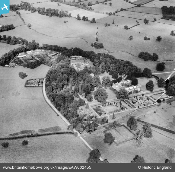
EAW002455 ENGLAND (1946). Longford Hall and Gardnes, Longford, 1946
© Copyright OpenStreetMap contributors and licensed by the OpenStreetMap Foundation. 2026. Cartography is licensed as CC BY-SA.
Nearby Images (13)
EAW002455

EAW002453

EAW002456

EAW002458

EAW002457

EAW002452

EAW002454

EAW002460

EAW002463

EAW002462

EAW002461

EAW002459

EAW002464

Details
| Title | [EAW002455] Longford Hall and Gardnes, Longford, 1946 |
| Reference | EAW002455 |
| Date | 6-September-1946 |
| Link | |
| Place name | LONGFORD |
| Parish | LONGFORD |
| District | |
| Country | ENGLAND |
| Easting / Northing | 421438, 338320 |
| Longitude / Latitude | -1.6809557330151, 52.94152758945 |
| National Grid Reference | SK214383 |
Pins

totoro |
Saturday 16th of November 2013 10:21:37 PM |