
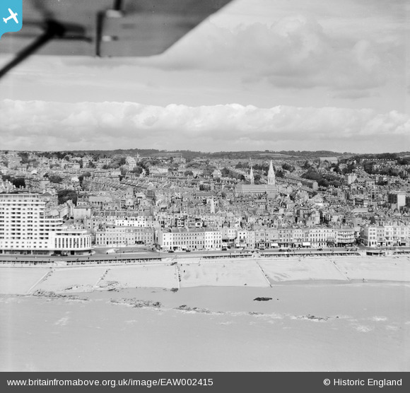
EAW002415 ENGLAND (1946). The seafront and town from Marine Court to London Road, Hastings, from the south-east, 1946
© Copyright OpenStreetMap contributors and licensed by the OpenStreetMap Foundation. 2026. Cartography is licensed as CC BY-SA.
Nearby Images (8)
EAW002415

EPW035344

EPW000114

EPW016890

EPW000117

EAW002414

EAW002416

EPW042841

Details
| Title | [EAW002415] The seafront and town from Marine Court to London Road, Hastings, from the south-east, 1946 |
| Reference | EAW002415 |
| Date | 16-September-1946 |
| Link | |
| Place name | HASTINGS |
| Parish | |
| District | |
| Country | ENGLAND |
| Easting / Northing | 580223, 108900 |
| Longitude / Latitude | 0.56061484308438, 50.850942707617 |
| National Grid Reference | TQ802089 |
Pins

redmist |
Tuesday 11th of October 2022 08:35:02 PM |