
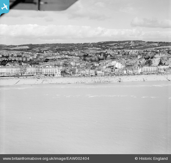
EAW002404 ENGLAND (1946). The town and seafront from Carlisle Road to Caroline Place, Hastings, from the south, 1946
© Copyright OpenStreetMap contributors and licensed by the OpenStreetMap Foundation. 2026. Cartography is licensed as CC BY-SA.
Nearby Images (7)
EAW002404

EAW002405

EAW002403

EAW002406

EPW039369

EPW039366

EPW039370

Details
| Title | [EAW002404] The town and seafront from Carlisle Road to Caroline Place, Hastings, from the south, 1946 |
| Reference | EAW002404 |
| Date | 16-September-1946 |
| Link | |
| Place name | HASTINGS |
| Parish | |
| District | |
| Country | ENGLAND |
| Easting / Northing | 581753, 109021 |
| Longitude / Latitude | 0.58238971824702, 50.851551055333 |
| National Grid Reference | TQ818090 |
Pins
Be the first to add a comment to this image!