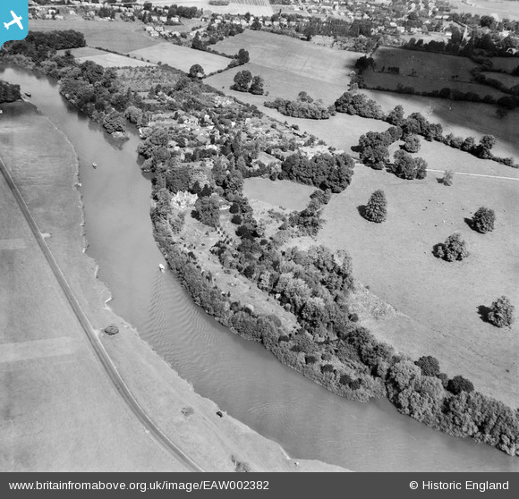
EAW002382 ENGLAND (1946). Magna Carta Island and the River Thames, Wraysbury, 1946
    © Copyright OpenStreetMap contributors and licensed by the OpenStreetMap Foundation. 2025. Cartography is licensed as CC BY-SA.
  
Details
| Title | [EAW002382] Magna Carta Island and the River Thames, Wraysbury, 1946 | 
| Reference | EAW002382 | 
| Date | 10-October-1946 | 
| Link | |
| Place name | WRAYSBURY | 
| Parish | WRAYSBURY | 
| District | |
| Country | ENGLAND | 
| Easting / Northing | 499964, 172989 | 
| Longitude / Latitude | -0.56137073392259, 51.446565917339 | 
| National Grid Reference | SU1000730 | 
Pins
| Class31 | Monday 27th of April 2015 04:47:53 PM | 
 
             
  ![[EAW002382] Magna Carta Island and the River Thames, Wraysbury, 1946](http://britainfromabove.org.uk/sites/all/libraries/aerofilms-images/public/100x100/EAW/002/EAW002382.jpg) 
  
                                          ![[EAW002383] Magna Carta Island and the River Thames, Wraysbury, 1946](http://britainfromabove.org.uk/sites/all/libraries/aerofilms-images/public/100x100/EAW/002/EAW002383.jpg) 
 ![[EPW006204] Magna Carta House and the River Thames, Magna Carta Island, 1921](http://britainfromabove.org.uk/sites/all/libraries/aerofilms-images/public/100x100/EPW/006/EPW006204.jpg) 
  River Thames, Runnymede,25/04/2015
 River Thames, Runnymede,25/04/2015