
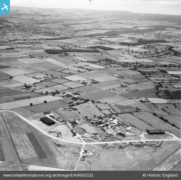
EAW002131 ENGLAND (1946). Wombleton Airfield, Wombleton, from the south-east, 1946
© Copyright OpenStreetMap contributors and licensed by the OpenStreetMap Foundation. 2026. Cartography is licensed as CC BY-SA.
Nearby Images (3)
EAW002131

EAW001010

EAW002128

Details
| Title | [EAW002131] Wombleton Airfield, Wombleton, from the south-east, 1946 |
| Reference | EAW002131 |
| Date | 1-August-1946 |
| Link | |
| Place name | WOMBLETON |
| Parish | WOMBLETON |
| District | |
| Country | ENGLAND |
| Easting / Northing | 466715, 482746 |
| Longitude / Latitude | -0.97630838396622, 54.235901120851 |
| National Grid Reference | SE667827 |
Pins

Sparky |
Tuesday 29th of August 2017 07:18:12 PM | |

Debz |
Sunday 13th of July 2014 03:02:28 PM | |
|
Debz |
Sunday 13th of July 2014 03:02:03 PM | |
|
Debz |
Sunday 13th of July 2014 02:59:13 PM | |
|
Debz |
Sunday 13th of July 2014 02:58:26 PM | |
|
Debz |
Sunday 13th of July 2014 02:57:41 PM | |
|
Debz |
Sunday 13th of July 2014 02:57:07 PM | |
|
Debz |
Sunday 13th of July 2014 02:56:25 PM | |
|
Debz |
Sunday 13th of July 2014 02:55:56 PM | |
|
Debz |
Sunday 13th of July 2014 02:55:28 PM | |
|
Debz |
Sunday 13th of July 2014 02:55:00 PM | |
|
Debz |
Sunday 13th of July 2014 02:54:14 PM | |
|
Debz |
Saturday 12th of July 2014 06:15:14 PM | |
|
Debz |
Saturday 12th of July 2014 06:14:46 PM | |
|
Debz |
Saturday 12th of July 2014 06:14:20 PM | |
|
Debz |
Saturday 12th of July 2014 06:13:29 PM | |
|
Debz |
Saturday 12th of July 2014 06:12:53 PM |