
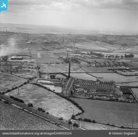
EAW002124 ENGLAND (1946). Samuel Cordingley Ltd Priestly Woollen Mill, Pudsey, from the west, 1946
© Copyright OpenStreetMap contributors and licensed by the OpenStreetMap Foundation. 2026. Cartography is licensed as CC BY-SA.
Nearby Images (8)
EAW002124

EAW002126

EAW002120

EAW002119

EAW002121

EAW002125

EAW002122

EAW002123

Details
| Title | [EAW002124] Samuel Cordingley Ltd Priestly Woollen Mill, Pudsey, from the west, 1946 |
| Reference | EAW002124 |
| Date | 1-August-1946 |
| Link | |
| Place name | PUDSEY |
| Parish | |
| District | |
| Country | ENGLAND |
| Easting / Northing | 422887, 434030 |
| Longitude / Latitude | -1.652458269188, 53.801852171922 |
| National Grid Reference | SE229340 |
