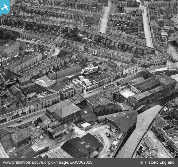
EAW002028 ENGLAND (1946). Tannery on the River Frome, Pennywell Road and Bean Street, Bristol, 1946
© Copyright OpenStreetMap contributors and licensed by the OpenStreetMap Foundation. 2026. Cartography is licensed as CC BY-SA.
Nearby Images (10)
Details
| Title | [EAW002028] Tannery on the River Frome, Pennywell Road and Bean Street, Bristol, 1946 |
| Reference | EAW002028 |
| Date | 29-July-1946 |
| Link | |
| Place name | BRISTOL |
| Parish | |
| District | |
| Country | ENGLAND |
| Easting / Northing | 360190, 174190 |
| Longitude / Latitude | -2.5731415147674, 51.464791828679 |
| National Grid Reference | ST602742 |
Pins

Sparky |
Monday 18th of September 2017 07:57:20 PM | |

Sparky |
Monday 18th of September 2017 07:56:15 PM | |

Class31 |
Wednesday 11th of December 2013 10:26:27 AM | |

Class31 |
Wednesday 11th of December 2013 10:22:24 AM | |

Class31 |
Wednesday 11th of December 2013 10:22:06 AM | |

Class31 |
Wednesday 11th of December 2013 10:21:43 AM | |

Class31 |
Wednesday 11th of December 2013 10:21:21 AM |
User Comment Contributions
View is looking south east |

Class31 |
Wednesday 11th of December 2013 10:20:24 AM |


![[EAW002028] Tannery on the River Frome, Pennywell Road and Bean Street, Bristol, 1946](http://britainfromabove.org.uk/sites/all/libraries/aerofilms-images/public/100x100/EAW/002/EAW002028.jpg)
![[EAW002030] Timber Yard off Pennywell Road and Bean Street, Bristol, 1946](http://britainfromabove.org.uk/sites/all/libraries/aerofilms-images/public/100x100/EAW/002/EAW002030.jpg)
![[EAW002029] Pennywell Road and Bean Street, Bristol, 1946](http://britainfromabove.org.uk/sites/all/libraries/aerofilms-images/public/100x100/EAW/002/EAW002029.jpg)
![[EAW002032] Bean Street and environs, Bristol, 1946](http://britainfromabove.org.uk/sites/all/libraries/aerofilms-images/public/100x100/EAW/002/EAW002032.jpg)
![[EAW002031] Bean Street and environs, Bristol, 1946](http://britainfromabove.org.uk/sites/all/libraries/aerofilms-images/public/100x100/EAW/002/EAW002031.jpg)
![[EAW002023] John Somers & Sons Packing Case Factory, Newfoundland Road Schools and environs, Bristol, 1946](http://britainfromabove.org.uk/sites/all/libraries/aerofilms-images/public/100x100/EAW/002/EAW002023.jpg)
![[EAW002026] John Somers & Sons Packing Case Factory, Newfoundland Road Schools and timber yard off Colston Place, Bristol, 1946](http://britainfromabove.org.uk/sites/all/libraries/aerofilms-images/public/100x100/EAW/002/EAW002026.jpg)
![[EAW002024] John Somers & Sons Packing Case Factory and Newfoundland Road Schools, Bristol, 1946](http://britainfromabove.org.uk/sites/all/libraries/aerofilms-images/public/100x100/EAW/002/EAW002024.jpg)
![[EAW002027] John Somers & Sons Packing Case Factory, Newfoundland Road Schools and environs, Bristol, 1946](http://britainfromabove.org.uk/sites/all/libraries/aerofilms-images/public/100x100/EAW/002/EAW002027.jpg)
![[EAW002025] John Somers & Sons Packing Case Factory, Newfoundland Road Schools and environs, Bristol, 1946](http://britainfromabove.org.uk/sites/all/libraries/aerofilms-images/public/100x100/EAW/002/EAW002025.jpg)