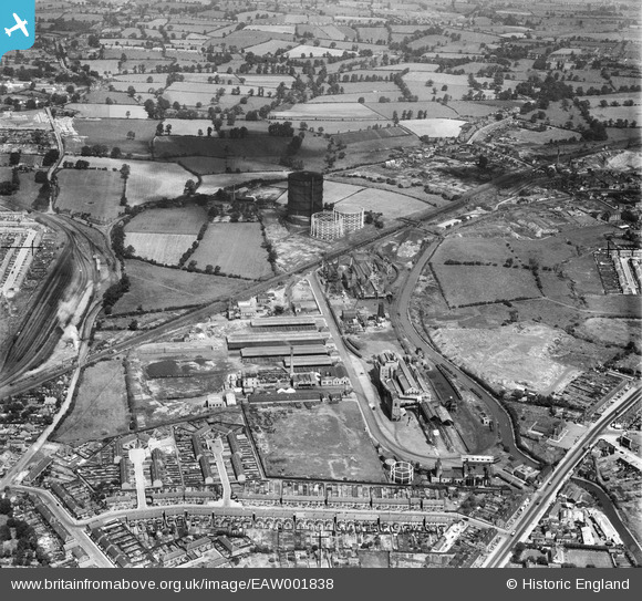
EAW001838 ENGLAND (1946). Housing off Arbury Avenue and the Gas Works at Longford alongside the Coventry Canal, Longford, 1946
© Copyright OpenStreetMap contributors and licensed by the OpenStreetMap Foundation. 2025. Cartography is licensed as CC BY-SA.
Nearby Images (11)
Details
| Title | [EAW001838] Housing off Arbury Avenue and the Gas Works at Longford alongside the Coventry Canal, Longford, 1946 |
| Reference | EAW001838 |
| Date | 12-July-1946 |
| Link | |
| Place name | LONGFORD |
| Parish | |
| District | |
| Country | ENGLAND |
| Easting / Northing | 434509, 283361 |
| Longitude / Latitude | -1.4922032672716, 52.446746952444 |
| National Grid Reference | SP345834 |


![[EAW001838] Housing off Arbury Avenue and the Gas Works at Longford alongside the Coventry Canal, Longford, 1946](http://britainfromabove.org.uk/sites/all/libraries/aerofilms-images/public/100x100/EAW/001/EAW001838.jpg)
![[EAW001837] The Gas Works at Longford and the surrounding industrial area alongside the Coventry Canal, Longford, 1946](http://britainfromabove.org.uk/sites/all/libraries/aerofilms-images/public/100x100/EAW/001/EAW001837.jpg)
![[EAW001839] The Gas Works at Longford and the surrounding industrial area alongside the Coventry Canal, Longford, 1946](http://britainfromabove.org.uk/sites/all/libraries/aerofilms-images/public/100x100/EAW/001/EAW001839.jpg)
![[EAW001836] The Gas Works at Longford and the surrounding industrial area alongside the Coventry Canal, Longford, 1946](http://britainfromabove.org.uk/sites/all/libraries/aerofilms-images/public/100x100/EAW/001/EAW001836.jpg)
![[EPW039612] Coventry Corporation Gas Works and environs, Longford, 1932](http://britainfromabove.org.uk/sites/all/libraries/aerofilms-images/public/100x100/EPW/039/EPW039612.jpg)
![[EPW039609] Coventry Corporation Gas Works, Filter Beds and environs, Longford, 1932](http://britainfromabove.org.uk/sites/all/libraries/aerofilms-images/public/100x100/EPW/039/EPW039609.jpg)
![[EAW001842] The Gas Works at Longford and the surrounding residential area, Longford, 1946](http://britainfromabove.org.uk/sites/all/libraries/aerofilms-images/public/100x100/EAW/001/EAW001842.jpg)
![[EPW039608] Coventry Corporation Gas Works, Filter Beds and environs, Longford, 1932](http://britainfromabove.org.uk/sites/all/libraries/aerofilms-images/public/100x100/EPW/039/EPW039608.jpg)
![[EAW001841] Housing off Arbury Avenue and the Gas Works at Longford, Longford, 1946](http://britainfromabove.org.uk/sites/all/libraries/aerofilms-images/public/100x100/EAW/001/EAW001841.jpg)
![[EAW001840] The Gas Works at Longford and the surrounding countryside, Longford, from the south-east, 1946](http://britainfromabove.org.uk/sites/all/libraries/aerofilms-images/public/100x100/EAW/001/EAW001840.jpg)
![[EPW027271] The Coventry Corporation Sewage Works off Bedlam Lane, Longford, 1929](http://britainfromabove.org.uk/sites/all/libraries/aerofilms-images/public/100x100/EPW/027/EPW027271.jpg)

