
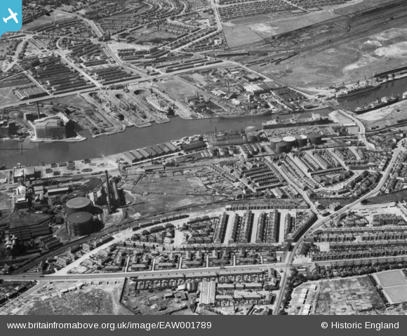
EAW001789 ENGLAND (1946). Poulton and the West Float, Birkenhead, 1946. This image has been produced from a print.
© Copyright OpenStreetMap contributors and licensed by the OpenStreetMap Foundation. 2026. Cartography is licensed as CC BY-SA.
Nearby Images (6)
EAW001789

EPW042647

EPW042648

EPW042645

EPW042646

EPW042644

Details
| Title | [EAW001789] Poulton and the West Float, Birkenhead, 1946. This image has been produced from a print. |
| Reference | EAW001789 |
| Date | 11-July-1946 |
| Link | |
| Place name | BIRKENHEAD |
| Parish | |
| District | |
| Country | ENGLAND |
| Easting / Northing | 330404, 390748 |
| Longitude / Latitude | -3.0470685758929, 53.408690625626 |
| National Grid Reference | SJ304907 |
Pins

Rachel |
Sunday 5th of November 2023 08:01:33 PM | |
|
Rachel |
Sunday 5th of November 2023 07:59:04 PM | |
|
Rachel |
Sunday 5th of November 2023 07:58:28 PM | |

Sparky |
Wednesday 13th of September 2017 07:57:16 AM | |
|
Jess |
Wednesday 17th of June 2015 06:11:36 PM | |
|
beast66606 |
Tuesday 9th of September 2014 09:37:37 AM | |
|
beast66606 |
Tuesday 9th of September 2014 09:37:06 AM | |
|
beast66606 |
Tuesday 9th of September 2014 09:36:34 AM |