
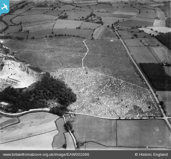
EAW001686 ENGLAND (1946). An area of cleared woodland beside Cloud Hill Quarry, Breedon on the Hill, 1946
© Copyright OpenStreetMap contributors and licensed by the OpenStreetMap Foundation. 2025. Cartography is licensed as CC BY-SA.
Nearby Images (3)
EAW001686

EAW001688

EAW001687

Details
| Title | [EAW001686] An area of cleared woodland beside Cloud Hill Quarry, Breedon on the Hill, 1946 |
| Reference | EAW001686 |
| Date | 12-July-1946 |
| Link | |
| Place name | BREEDON ON THE HILL |
| Parish | BREEDON ON THE HILL |
| District | |
| Country | ENGLAND |
| Easting / Northing | 441614, 321186 |
| Longitude / Latitude | -1.3828965928341, 52.786309339699 |
| National Grid Reference | SK416212 |
Pins
Be the first to add a comment to this image!