
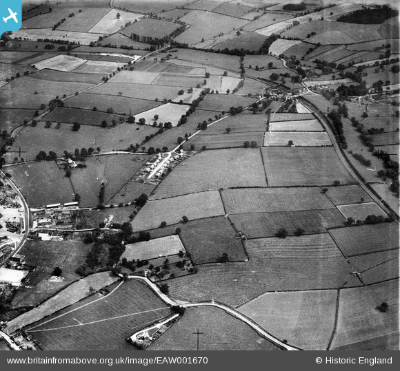
EAW001670 ENGLAND (1946). Berry Avenue and environs, Breedon on the Hill, 1946
© Copyright OpenStreetMap contributors and licensed by the OpenStreetMap Foundation. 2026. Cartography is licensed as CC BY-SA.
Nearby Images (4)
EAW001670

EAW001690

EAW001689

EAW001669

Details
| Title | [EAW001670] Berry Avenue and environs, Breedon on the Hill, 1946 |
| Reference | EAW001670 |
| Date | 12-July-1946 |
| Link | |
| Place name | BREEDON ON THE HILL |
| Parish | BREEDON ON THE HILL |
| District | |
| Country | ENGLAND |
| Easting / Northing | 441189, 322971 |
| Longitude / Latitude | -1.3889737918733, 52.802389128112 |
| National Grid Reference | SK412230 |
Pins
Be the first to add a comment to this image!