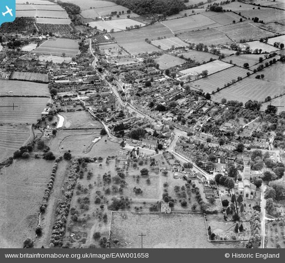
EAW001658 ENGLAND (1946). The town, Chipping Campden, from the north-east, 1946
© Copyright OpenStreetMap contributors and licensed by the OpenStreetMap Foundation. 2025. Cartography is licensed as CC BY-SA.
Nearby Images (6)
Details
| Title | [EAW001658] The town, Chipping Campden, from the north-east, 1946 |
| Reference | EAW001658 |
| Date | 12-July-1946 |
| Link | |
| Place name | CHIPPING CAMPDEN |
| Parish | CHIPPING CAMPDEN |
| District | |
| Country | ENGLAND |
| Easting / Northing | 415523, 239314 |
| Longitude / Latitude | -1.7736016471093, 52.051577155012 |
| National Grid Reference | SP155393 |


![[EAW001658] The town, Chipping Campden, from the north-east, 1946](http://britainfromabove.org.uk/sites/all/libraries/aerofilms-images/public/100x100/EAW/001/EAW001658.jpg)
![[EPW026860] The remains of Campden House, Chipping Campden, 1929](http://britainfromabove.org.uk/sites/all/libraries/aerofilms-images/public/100x100/EPW/026/EPW026860.jpg)
![[EPW026866] St James's Church and environs, Chipping Campden, 1929](http://britainfromabove.org.uk/sites/all/libraries/aerofilms-images/public/100x100/EPW/026/EPW026866.jpg)
![[EPW026861] St James's Church, Chipping Campden, 1929](http://britainfromabove.org.uk/sites/all/libraries/aerofilms-images/public/100x100/EPW/026/EPW026861.jpg)
![[EPW026864] St James's Church and environs, Chipping Campden, 1929](http://britainfromabove.org.uk/sites/all/libraries/aerofilms-images/public/100x100/EPW/026/EPW026864.jpg)
![[EPW026867] St James's Church and environs, Chipping Campden, 1929](http://britainfromabove.org.uk/sites/all/libraries/aerofilms-images/public/100x100/EPW/026/EPW026867.jpg)
