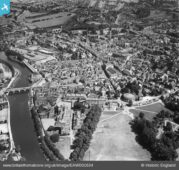
EAW001634 ENGLAND (1946). The town centre, Shrewsbury, from the west, 1946
    © Copyright OpenStreetMap contributors and licensed by the OpenStreetMap Foundation. 2025. Cartography is licensed as CC BY-SA.
  
Nearby Images (6)
Details
| Title | [EAW001634] The town centre, Shrewsbury, from the west, 1946 | 
| Reference | EAW001634 | 
| Date | 12-July-1946 | 
| Link | |
| Place name | SHREWSBURY | 
| Parish | SHREWSBURY | 
| District | |
| Country | ENGLAND | 
| Easting / Northing | 348709, 312555 | 
| Longitude / Latitude | -2.7592434180161, 52.707885298355 | 
| National Grid Reference | SJ487126 | 
Pins
Be the first to add a comment to this image!
 
             
  ![[EAW001634] The town centre, Shrewsbury, from the west, 1946](http://britainfromabove.org.uk/sites/all/libraries/aerofilms-images/public/100x100/EAW/001/EAW001634.jpg) 
  
                                          ![[EPW017983] Priory Road and environs, Shrewsbury, 1927. This image has been produced from a copy-negative.](http://britainfromabove.org.uk/sites/all/libraries/aerofilms-images/public/100x100/EPW/017/EPW017983.jpg) 
 ![[EPW017972] St Chad's Church and environs, Shrewsbury, 1927. This image has been produced from a copy-negative.](http://britainfromabove.org.uk/sites/all/libraries/aerofilms-images/public/100x100/EPW/017/EPW017972.jpg) 
 ![[EPW040081] The Quarry, St Chad's Church and environs, Shrewsbury, 1932](http://britainfromabove.org.uk/sites/all/libraries/aerofilms-images/public/100x100/EPW/040/EPW040081.jpg) 
 ![[EPW018045] St Chad's Church and the town centre, Shrewsbury, from the south-west, 1927](http://britainfromabove.org.uk/sites/all/libraries/aerofilms-images/public/100x100/EPW/018/EPW018045.jpg) 
 ![[EPW017974] Welsh Bridge, Shrewsbury, 1927. This image has been produced from a copy-negative.](http://britainfromabove.org.uk/sites/all/libraries/aerofilms-images/public/100x100/EPW/017/EPW017974.jpg)